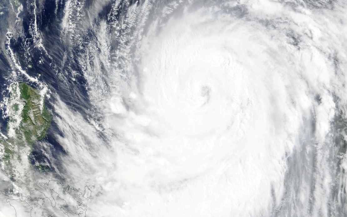
Taiwan's Central Weather Bureau issued a sea warning Thursday afternoon as Typhoon Bavi continued its dangerous approach toward the island nation, with officials preparing residents for potentially severe impacts. The ninth major typhoon of the year prompted warnings covering waters off Taiwan's northeastern and southeastern coasts, including the territories of Orchid Island and Green Island, with the Bashi Channel also placed under alert as the storm system tracked steadily closer.
At the time of the warning, Bavi was positioned to the southeast of Eluanbi, Taiwan's southernmost geographical point, moving on a northwesterly trajectory that would carry it directly toward the populated island. The meteorological agency reported that the typhoon had strengthened substantially, with maximum sustained winds measured at 51 metres per second near the eye, while gusts in the most violent bands reached dangerous speeds of 63 metres per second. These wind velocities positioned Bavi among the more powerful storms of the current Pacific typhoon season and suggested significant destructive potential across Taiwan.
Forecasters tracking the system indicated that Bavi would maintain a northwest movement at speeds of 15 to 20 kilometres per hour, placing the island squarely in the path of the advancing weather front. Rather than passing to the south or north, the projected track showed the typhoon would likely cross Taiwan's northern regions, delivering impacts consistent with either a strong upper-tier moderate typhoon or a lower-range powerful typhoon classification. This positioning meant that much of Taiwan's northern and central population centres would experience the storm's full effects, particularly intense precipitation and damaging winds.
The approaching cyclone had already begun disrupting normal economic and social activity across the region. Most commercial air services connecting Taiwan with neighbouring Okinawa had been cancelled in anticipation of deteriorating conditions, while several major international long-haul flights were also suspended or rescheduled. These cancellations reflected the aviation industry's precautionary approach to severe weather systems, as the combination of strong winds and heavy rain creates hazardous conditions for takeoff and landing operations.
Maritime transport also faced significant disruption as ferry operators suspended multiple route services connecting Taiwan with nearby islands and regional destinations. The decision to halt ferry operations demonstrated the serious threat posed by the advancing system, as rough seas and poor visibility would render vessel operations unsafe for passengers and crew members. Additionally, Taiwan's mountain roads and highland routes were placed under alert status, with authorities warning of landslide risks and hazardous driving conditions as torrential rainfall saturated terrain and reduced visibility to dangerous levels.
The timing of Bavi's arrival during the summer season meant that tropical storm systems posed particular challenges for Taiwan's densely populated island. The combination of high precipitation rates typical of Pacific typhoons and Taiwan's mountainous terrain creates elevated risks of flooding, landslides, and debris flows that can impact populated areas downstream from affected highlands. Local governments had begun preparatory measures including securing loose outdoor structures, clearing drainage systems, and ensuring emergency response teams were positioned to respond to weather-related incidents.
For Malaysia and the broader Southeast Asian region, Bavi's trajectory remained a matter of monitoring, though the current forecasted path suggested the storm would remain focused on Taiwan and potentially affect southern Japan. However, the strong monsoon patterns that characterise the region during this season can sometimes push typhoon remnants across wider areas, meaning neighbouring territories needed to track the system's eventual dissipation and any secondary impacts that might develop. The timing of Bavi within the active typhoon season underscored the region's vulnerability to these powerful weather systems.
Taiwan's response to Bavi demonstrated the nation's well-established protocols for handling severe tropical storms developed through decades of experience with typhoons. The early issuance of warnings, sequential alert escalation from sea warnings to land warnings, and coordination with transportation providers reflected institutional knowledge about managing these periodic natural disasters. The willingness to cancel flights and ferry services ahead of the system's arrival, rather than waiting for conditions to deteriorate, reflected lessons learned from previous storms that caused chaos when operators delayed precautionary measures.
As Bavi continued its approach, Taiwanese residents prepared for several days of significant weather disruption. Schools and offices made contingency plans for potential closures, grocery stores experienced increased customer traffic as families stocked supplies, and emergency shelters were prepared in vulnerable coastal and low-lying areas. The typhoon season in Taiwan typically extends from July through September, with August and September historically experiencing the highest frequency and most intense storms. Bavi's arrival in early July signalled that the region was entering the active portion of the annual cycle, with residents facing the prospect of multiple similar systems over the coming months.

