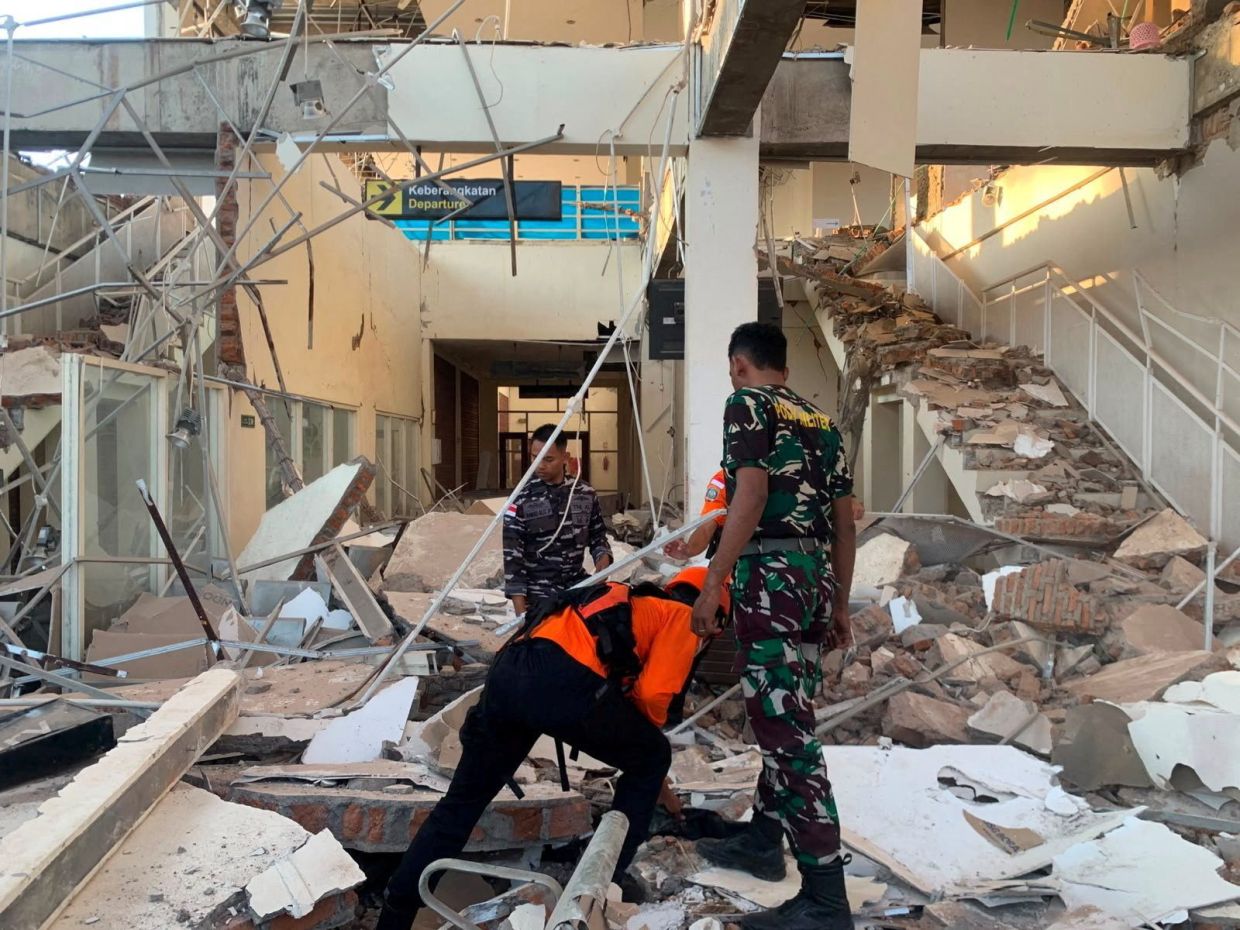
A devastating magnitude 7.7 earthquake struck off the coast of Indonesia's Flores region in the early hours of Saturday, August 15, destroying numerous buildings and homes across the island and claiming at least two lives in a region historically vulnerable to seismic disasters. The tremor, which occurred at 5:58 a.m. local time, was centred 68 kilometres north-northwest of the city of Ende in East Nusa Tenggara province at a depth of 10 kilometres, according to the U.S. Geological Survey. The initial powerful jolt was followed by several aftershocks that rattled communities already on edge from the main quake.
Indonesian authorities swiftly issued a tsunami warning in the immediate aftermath, alerting residents across East Nusa Tenggara, West Nusa Tenggara, South Sulawesi and Southeast Sulawesi provinces to evacuate beaches and riverbanks and move to higher ground. However, the tsunami threat was downgraded within hours after Indonesia's Meteorology, Climatology and Geophysics Agency conducted detailed monitoring and determined that sea-level changes remained within safe parameters, posing no significant danger to coastal populations. This reassessment allowed many residents and businesses to return to their normal activities, though structural damage assessments continued throughout the affected areas.
The earthquake's destructive force was immediately apparent across Flores island. Preliminary reports from the Maumere Search and Rescue Agency confirmed at least two fatalities and two injured persons resulting directly from the quake's violence, though authorities cautioned that the final death toll could rise as rescue operations expanded and remote areas were assessed. Video footage broadcast on local television stations captured chaotic scenes at multiple hospitals, where medical staff urgently evacuated patients from buildings as a precautionary measure. Healthcare workers hastily established makeshift treatment areas in open spaces, moving beds, intravenous stands, oxygen cylinders and other essential medical equipment outdoors to maintain emergency response capacity while structural integrity of hospital buildings was evaluated.
Eyewitness accounts painted a picture of widespread destruction and considerable public alarm. Yohanna Embu, a resident of Sikka regency within East Nusa Tenggara province, described observing numerous damaged structures throughout her community as terrified residents rushed toward higher elevations. She specifically noted the collapse of the waiting room facility at the port terminal in Maumere, a major hub for inter-island transport. The severity of structural damage suggested that building codes may not have been universally applied or that older constructions had deteriorated to the point where they could not withstand significant seismic forces.
The earthquake's impact extended to religious institutions on this predominantly Catholic island. Students and nuns attending early morning Mass at St. Peter Major Seminary in Sikka, locally known as Ritapiret Seminary, fled in panic as the roof of an assembly hall began collapsing around them. The Reverend Guidelbertus Tanga, rector of the seminary, reported that the chaotic evacuation resulted in at least one priest sustaining a fractured leg after jumping from the second floor of a building. Such incidents underscore the unpredictable dangers posed by structural collapse during seismic events and the split-second decisions individuals must make when facing immediate threats.
Indonesia's position on the Pacific Ring of Fire makes the nation exceptionally prone to earthquakes and volcanic activity. This 40,000-kilometre arc encompasses some of the world's most seismically and volcanically active zones, stretching across the Pacific Basin and encompassing major fault lines that continuously interact beneath and around the Indonesian archipelago of more than 17,000 islands. The region's tectonic complexity means that major earthquakes occur regularly, though their timing and exact locations remain difficult to predict with precision.
The Flores region has a particularly tragic recent history with seismic disasters. In December 1992, a powerful earthquake generated a devastating tsunami that swept across the southeastern island of Flores, killing approximately 2,500 people and leaving communities devastated for years. That catastrophic event remains seared into the regional memory and explains the heightened anxiety among residents when earthquake alarms sound. Saturday's occurrence inevitably triggered recollections of that disaster, even though initial tsunami assessments suggested the immediate threat was less severe.
The earthquake demonstrates the ongoing vulnerability of Indonesian communities to natural disasters and raises questions about disaster preparedness infrastructure and building resilience standards across the archipelago. While early warning systems and evacuation procedures appear to be functioning adequately, the continued occurrence of structural collapses and injuries suggests that improvements in building codes enforcement and retrofitting of older structures remain necessary priorities. For Malaysia and other Southeast Asian nations sharing the region's seismic and volcanic characteristics, Indonesia's experiences provide valuable lessons in comprehensive disaster management and the importance of sustained investment in earthquake-resistant infrastructure and community preparedness programs that can reduce casualties and property damage when major tremors inevitably strike.

