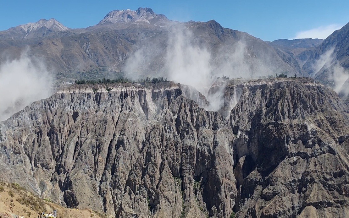
A substantial 6.7 magnitude earthquake jolted southern Peru on Thursday afternoon, prompting disaster management agencies to issue safety alerts throughout the country. The US Geological Survey confirmed the tremor, while Peru's Geophysical Institute (IGP) recorded measurements indicating a 7.2 magnitude event occurring at precisely 1 pm local time. The seismic event originated at an intermediate depth of 108 kilometres beneath the surface, with its epicentre positioned approximately 35 kilometres north of Coracora in the Parinacochas province of Ayacucho department.
What initially appeared as a potentially catastrophic event proved far less destructive than the magnitude alone might suggest. Peruvian emergency response authorities and disaster risk management agencies confirmed no deaths or significant structural damage in the immediate aftermath. This fortunate outcome stemmed directly from the earthquake's substantial depth, which allowed the ground to absorb and dissipate considerable seismic energy before it reached populated areas. Geophysicists explained that the 108-kilometre depth substantially reduced the intensity of ground shaking at the surface, resulting in what seismologists classify as Mercalli intensity ratings of III to IV, corresponding to light to moderate shaking in areas closest to the epicentre.
The tremor was perceptible across a vast geographic area spanning southern and central Peru. Residents from the remote Ayacucho highlands to Lima, the nation's capital situated hundreds of kilometres away on the central coast, reported feeling the ground movement. This wide distribution of perceptible shaking underscored the considerable energy released during the event, even as the deep focal depth prevented widespread devastation. The fact that Lima's residents detected the tremor illustrated how seismic waves propagate through the Earth's crust over extensive distances, particularly when earthquakes occur at intermediate to deep focal depths.
Thursday's earthquake forms part of an ongoing pattern of elevated seismic activity affecting both the northern and southern regions of Peru. The country sits astride the Pacific Ring of Fire, a tectonically active zone encircling the Pacific Ocean where roughly 90 per cent of the world's earthquakes occur. This geographic reality means Peruvians live with earthquake risk as a permanent feature of their environment. The IGP responded to the recent tremors by reminding the public of fundamental earthquake preparedness measures, including reviewing evacuation routes from homes and workplaces, updating emergency supply kits, and maintaining awareness of safe locations within buildings.
Historical context provides sobering perspective on Peru's seismic vulnerability. The 2007 earthquake that devastated the Ica region, located south of Lima, measured 7.9 magnitude and claimed approximately 600 lives. That disaster demonstrated how earthquakes of similar or slightly greater magnitude than Thursday's event could prove catastrophic when they occur at shallower depths and in areas with vulnerable building stock or high population density. The contrast between Thursday's high-magnitude but ultimately benign event and 2007's tragedy illustrates how depth and location combine with population factors to determine earthquake impact.
Peruvian disaster management authorities have leveraged Thursday's reminder of seismic risk to reinforce public education campaigns. The IGP's National Seismological Centre (CENSIS) emphasised the importance of individual and household preparedness, particularly in regions where building construction standards may not meet modern earthquake-resistant specifications. For Malaysian readers, Peru's situation offers relevant lessons about seismic risk management in tectonically active regions. Malaysia itself experiences occasional minor earthquakes, particularly in Sabah and Sarawak, where the country's eastern regions sit near the Sunda Plate boundary.
The technical aspects of Thursday's earthquake carry implications for seismologists and structural engineers across the Pacific Ring of Fire region. The intermediate depth classification—generally defined as 70 to 300 kilometres—occupies a complex position in seismic hazard assessment. While intermediate-depth earthquakes release tremendous energy, that energy dissipates through the Earth's interior rather than being transmitted efficiently to the surface as violent ground acceleration. This explains why a 6.7 to 7.2 magnitude intermediate-depth earthquake produces less surface damage than a similar-magnitude shallow earthquake would cause. Understanding these mechanisms remains crucial for building code development and hazard mitigation planning throughout seismically active regions.
Peru's response to Thursday's earthquake reflects decades of accumulated experience with seismic events. The country maintains sophisticated monitoring networks and well-developed emergency protocols. The rapid assessment confirming no casualties or major damage likely resulted from both the earthquake's inherent characteristics and Peru's institutional preparedness. Emergency response personnel stationed throughout the affected regions could quickly verify conditions and relay information to central authorities. This systematic approach to earthquake monitoring and response provides a model for other nations in tectonically active zones seeking to minimise casualties and economic loss.
Looking forward, Peruvian authorities face the continuing challenge of balancing preparedness with daily life in an earthquake-prone environment. The IGP will continue monitoring seismic activity across the country, tracking whether Thursday's earthquake represents an isolated event or signals the beginning of an active seismic sequence. Historically, significant earthquakes sometimes trigger aftershocks or activate nearby faults, though many substantial earthquakes occur with minimal subsequent activity. The public has been advised to remain attentive to official communications from seismic monitoring agencies, a reasonable precaution given Peru's location on one of Earth's most seismically dynamic regions.

