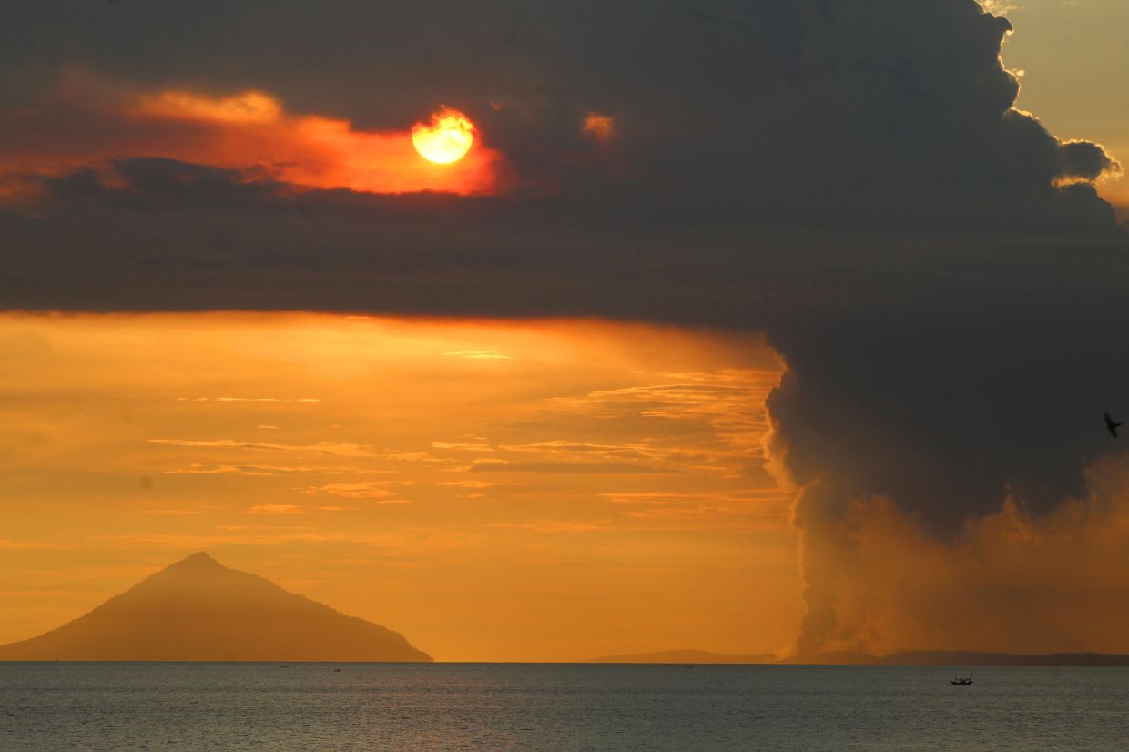
Mount Anak Krakatau roared to life on Tuesday morning, July 7, shooting a column of ash 100 metres into the sky in what marks an escalation of the volcano's growing unrest. The eruption occurred at 8:21 a.m., according to Indonesia's Geological Agency of the Energy and Mineral Resources (ESDM), with seismic instruments recording a maximum amplitude of 11 millimetres and lasting approximately 15 seconds. The dense gray plume drifted north-westward from the crater, a familiar pattern that authorities are closely tracking as part of their heightened surveillance protocol across the Sunda Strait.
The volcano's activity has dramatically intensified since early June, when Mount Anak Krakatau began shaking itself awake after an extended quiet period. Starting June 10, monitoring stations detected the first signs of renewed unrest, though the situation deteriorated markedly between June 18 and 19, when eruption tremors and low-frequency earthquakes averaged more than 50 daily events. The frequency continued its upward trajectory through early July, reaching an average of 97 events per day between June 16 and July 2. This sustained acceleration prompted Indonesia's Geological Agency to elevate the volcano's status from Level II (Alert) to Level III (Watch) on Friday—the second-highest tier in Indonesia's four-tiered volcanic alert classification system.
The shift to Level III status reflects genuine concern among volcanologists monitoring the mountain. Andi Suwardi, head of the Mount Anak Krakatau Observation Post in South Lampung, emphasised that despite the heightened alert level, the volcano's status remains unchanged even as eruptions continue with fluctuating intensity. This measured language reflects the delicate position authorities occupy: balancing the need to communicate genuine risk without unnecessarily alarming communities dependent on waters surrounding the volcano. The 24-hour surveillance teams at the observation post continue tracking key indicators including ash column height, seismic activity patterns, and ground deformation, searching for any signals that might presage a more significant eruption.
Authorities have established a three-kilometre exclusion zone around the volcano's crater, effectively barring recreational access and commercial operations. However, enforcement remains problematic in an economically struggling region where fishermen and tourism operators view the restrictions as threats to their livelihoods. South Lampung Regent Radityo Egi Pratama acknowledged this tension, recognising that heightened volcanic activity has disrupted the economic activities of communities reliant on maritime industries and tourism. Yet he unambiguously prioritised safety, urging fishermen and tourism operators to stay away from Mount Anak Krakatau until the alert status is downgraded. His plea reflected an understanding that income generation, however urgent for struggling operators, cannot justify the risks inherent in approaching an active volcano.
The historical context of Mount Anak Krakatau looms large over current concerns. The volcano itself—whose name translates to "Child of Krakatau"—emerged from the sea in 1927, rising from the caldera left behind by the catastrophic 1883 eruption of its parent mountain. That earlier cataclysm remains one of history's deadliest volcanic disasters, with powerful explosions and accompanying tsunamis claiming an estimated 36,000 lives across the region. The 1883 eruption ejected such vast quantities of material into the atmosphere that it disrupted global weather patterns and influenced climate systems worldwide, demonstrating the regional and international consequences of major Sunda Strait volcanic events.
More recently, Mount Anak Krakatau reminded the region of its destructive potential on December 22, 2018, when a partial collapse of the volcano's flank triggered a tsunami that devastated coastal areas of southern Sumatra and western Banten. That disaster killed at least 429 people and injured more than 7,200 others, making it a fresh wound in collective regional memory. The 2018 event demonstrated that even a relatively young volcano, barely a century old, possesses sufficient energy to cause regional catastrophe. This backdrop explains why authorities treat current activity seriously and why public compliance with exclusion zones is genuinely vital rather than merely bureaucratic.
The challenges facing Indonesian authorities extend beyond volcano monitoring to include managing human behaviour in economically fragile zones. The fact that some fishermen and tourism operators continue venturing into restricted areas, attempting to evade official monitoring, reflects the desperation of communities for whom maritime income represents survival. Yet this same behaviour creates moral hazard, as individuals betting their lives on the volcano remaining contained inevitably create rescue obligations should events deteriorate. The regional government's emphasis on safety must contend with this economic reality, and longer-term solutions likely require assistance packages or alternative income schemes for affected communities.
For Malaysian readers, the significance extends beyond general interest in Indonesian natural disasters. The Sunda Strait lies directly north of Malaysian territorial waters, and serious volcanic activity there carries potential implications for the region. A major eruption comparable to the 1883 event could generate tsunamis affecting Malaysian coasts, disrupt air traffic across Southeast Asia, and create economic repercussions throughout the region. Additionally, ash distribution patterns from Krakatau-area eruptions historically affect air quality across Malaysia and Singapore, as prevailing wind patterns can carry volcanic particulates southeastward. The current alert level remains below those that typically trigger cross-border health warnings, but monitoring Mount Anak Krakatau's progression is relevant to Malaysian disaster preparedness planning.
The broader vulnerability of Southeast Asia to volcanic hazards deserves consideration amid Indonesia's current challenges. The entire region sits atop the Pacific Ring of Fire, with multiple active volcanoes capable of generating serious disruptions. Indonesia itself hosts the world's largest concentration of active volcanoes, creating a unique vulnerability profile. The 2004 Indian Ocean earthquake and tsunami demonstrated that natural disasters can cascade across borders and disrupt economies throughout the region. While Mount Anak Krakatau's current activity may ultimately prove to be a brief intensification rather than the prelude to a major eruption, the vigilance being exercised represents sound regional risk management.
Moving forward, the key variables remain the volcano's seismic patterns, ground deformation measurements, and gas emission rates—parameters that volcanologists will continue analysing daily. If activity subsides and tremor frequencies decline to baseline levels, authorities will likely downgrade the alert status, allowing economic activities to resume. Conversely, further escalation would trigger additional restrictions and potentially mandatory evacuations of communities in low-lying coastal areas vulnerable to tsunami generation. The observation posts maintain their constant watch, knowing that Mount Anak Krakatau's history suggests its periods of activity can last weeks, months, or longer, and that predicting the precise trajectory of volcanic unrest remains among volcanology's most frustrating challenges.

