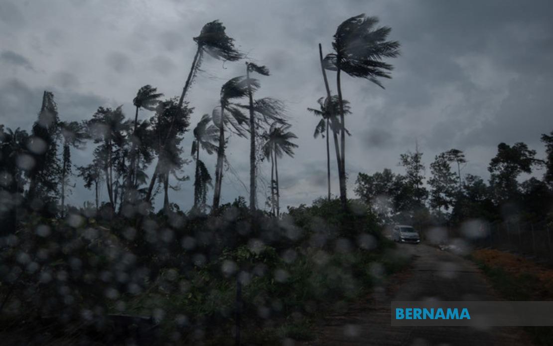
Residents across multiple Malaysian states face severe weather conditions this morning, with the Malaysian Meteorological Department issuing alerts for thunderstorms, heavy rain and powerful winds lasting until 1pm. The forecasts, communicated at 8.35 am, cover a broad geographic area spanning both Peninsular Malaysia and the East Malaysian state of Sarawak, prompting the public to exercise caution during travel and outdoor activities.
On the Peninsula, the warning encompasses the entirety of Perlis and Melaka, marking these two states as areas of particular concern. Within Kedah, the high-risk zones narrow to Langkawi, Kubang Pasu and Kota Setar, regions that frequently experience volatile weather patterns during monsoon seasons. The inclement conditions are expected to arrive and dissipate within a compressed timeframe, creating a brief window of heightened meteorological intensity that commuters and outdoor workers should monitor closely.
Pahang faces threats across three municipalities: Kuantan, the state capital and major commercial hub; Pekan, home to the royal palace and situated along the eastern coast; and Jerantut, an inland town known for its proximity to the Taman Negara national park. In Selangor, Sepang and Kuala Langat have been flagged as vulnerable areas, with Sepang particularly significant given its proximity to Kuala Lumpur International Airport and major transportation corridors. Negeri Sembilan residents in Port Dickson, Seremban, Rembau, Kuala Pilah and Tampin should prepare for disruptions, while Johor's southern towns of Tangkak and Muar join the growing list of affected municipalities.
Across the South China Sea, Sarawak residents in several districts must similarly brace for turbulent weather. Mukah, Selangau, Sibu, Sarikei and Maradong represent major population centres and transport hubs along the central coast. The warning also extends to Bintulu, Kapit, Bukit Mabong and Subis in Miri division, encompassing both urban areas and more remote interior regions where flash flooding poses particular risks due to topography and drainage limitations.
The Malaysian Meteorological Department classifies this as a short-term weather warning, meaning the advisory carries validity only for periods not exceeding six hours at a time. This distinction is important for understanding the meteorological assessment: rather than a sustained weather system, these represent acute conditions generated by atmospheric instability expected to resolve relatively quickly. The staggered nature of such warnings reflects the department's commitment to providing timely updates as conditions develop or dissipate.
Thunderstorms of this character typically bring significant disruption to daily operations across affected regions. Flight schedules at regional airports may experience delays, while road conditions could deteriorate rapidly due to surface water accumulation and reduced visibility. Public transport users should anticipate delays, and businesses reliant on outdoor operations face temporary cessations. The combination of heavy precipitation, lightning and strong gusts creates hazardous conditions for pedestrians and cyclists, particularly near construction sites or areas with loose fixtures.
For motorists traversing the affected zones, the convergence of thunderstorms and heavy rain demands heightened vigilance. Visibility can diminish sharply during intense downpours, while wind gusts may affect vehicle stability, especially for lighter vehicles and those towing cargo. Federal and state roads running through warned areas, including major arteries connecting major cities, may experience congestion as drivers adopt defensive speeds and increase following distances.
The geographic breadth of this warning underscores the regional nature of the atmospheric system generating these conditions. Rather than isolated thundercells, this appears to be a coordinated weather phenomenon affecting disparate areas simultaneously, likely driven by moisture convergence and atmospheric lift associated with regional wind patterns. The fact that both peninsular and East Malaysian locations feature on the alert list suggests involvement of broader monsoonal influences or intercontinental air mass interactions.
For residents in these areas, the practical response involves basic precautions: securing loose outdoor items, charging electronic devices in preparation for potential power interruptions, and monitoring weather updates from MetMalaysia. Drivers should refuel vehicles before conditions deteriorate, while businesses dependent on continuous operations might consider implementing contingency protocols. Parents should remain alert regarding children's outdoor activities, particularly near bodies of water where flash flooding poses drowning risks.
The Malaysian Meteorological Department's alert system, refined through decades of monitoring, provides crucial early warning that allows residents and authorities to implement protective measures. The specific timing—valid only until 1pm—means affected areas can anticipate clear conditions by early afternoon, permitting resumption of normal activities once the system passes. However, residents should remain attuned to subsequent updates, as meteorological conditions can shift unexpectedly, potentially extending warnings or introducing new areas of concern.

