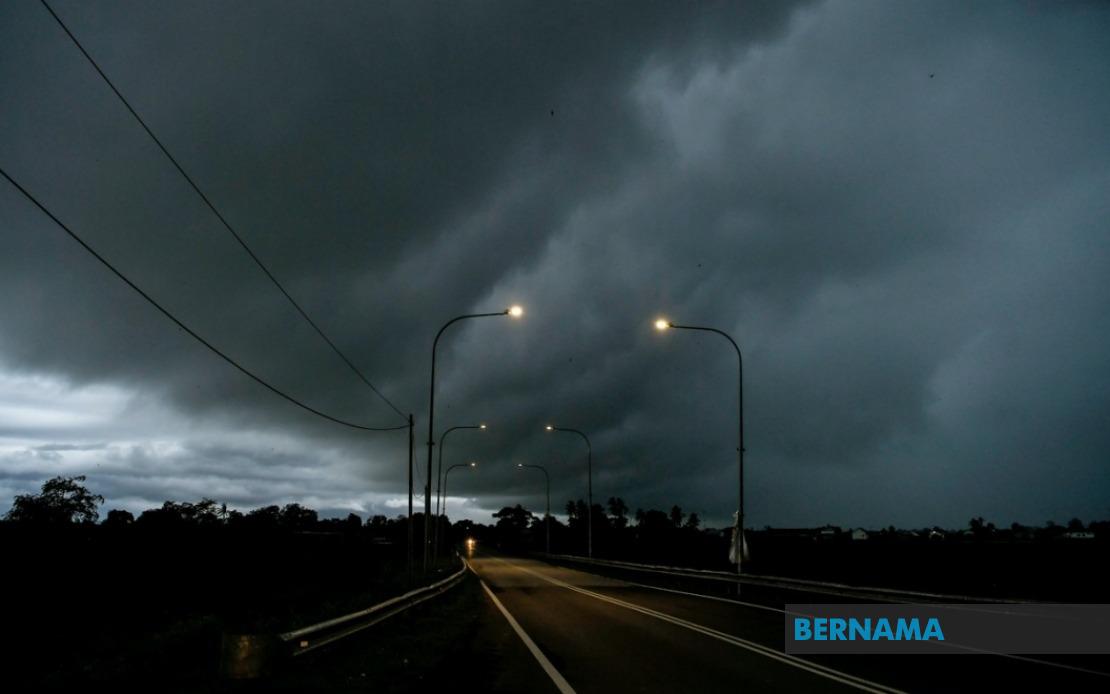
The Malaysian Meteorological Department has activated severe weather alerts across a broad swathe of the nation, warning residents in nine states and the federal territory of Labuan to brace for thunderstorms, heavy downpours and gusty winds through 9 pm today. The advisory encompasses multiple regions stretching from the northern peninsula down through the east coast and into both East Malaysian states, reflecting the widespread nature of the atmospheric disturbance.
In the northern corridor, the entire state of Perlis falls within the warning zone. Neighbouring Kedah faces potential severe weather in its northwestern districts including the island of Langkawi alongside mainland areas such as Kubang Pasu, Kota Setar, Pokok Sena, Padang Terap, Sik and Baling. The neighbouring state of Perak has also been placed on alert, with districts including Kerian, Larut, Matang and Selama, Kuala Kangsar, Kinta and Kampar expected to experience the brunt of the incoming system.
Moving southward along the peninsula, the high-risk zone extends into the central and eastern regions. Pahang's vulnerable areas comprise its highland districts of Cameron Highlands, along with Bentong, Bera and Rompin in the lower elevations. Within Selangor, the inland Hulu Langat district has been flagged for dangerous conditions. The southern reaches of Peninsular Malaysia are also in the meteorological crosshairs, with Negeri Sembilan's districts of Jelebu and Jempol placed under alert, whilst Johor residents in Segamat, Kluang and Mersing should prepare for severe weather.
Beyond the peninsula, Sarawak faces one of the most fragmented warning patterns, with multiple districts across different divisions expected to encounter thunderstorms and heavy rainfall. The affected Sarawak localities span Kuching's outlying areas of Bau and central Kuching itself, the Serian district, Samarahan's namesake district and Asajaya, Sarikei's Meradong, Sibu, and Mukah's Tanjung Manis region. Inland, the warning extends to Kapit's Song and Kapit districts, whilst northern Sarawak sees Bintulu's Tatau and Sebauh and Miri's Marudi district under alert. The coastal Limbang division likewise remains under the thunderstorm warning.
Sabah's vast territory also sits within the danger zone, with the meteorological alert covering interior upland regions including Sipitang, Kuala Penyu, Beaufort and Tambunan, the expansive west coast districts, and the eastern divisions of Sandakan, specifically Tongod and Kinabatangan. This geographic spread underscores the scale of the weather system affecting the East Malaysian state. The cumulative coverage indicates a significant atmospheric event capable of affecting millions of residents across multiple time zones and climatic zones.
Thunderstorm warnings of this breadth typically indicate strong convective activity, possibly associated with a monsoon trough or confluence zone that has established itself over Malaysian territory. Such systems can generate intense rainfall within short timeframes, creating localised flooding in low-lying areas, flash flooding in river systems, and dangerous conditions for outdoor activities. The strong winds component adds another hazard layer, potentially causing structural damage, tree uprooting and dangerous conditions for high-sided vehicles on exposed routes.
For Malaysian residents and businesses, such alerts serve as critical planning instruments. Communities in affected districts should secure loose outdoor items, monitor local drainage systems for blockages, and prepare contingency plans for potential disruptions to transportation and supply chains. Those engaged in water-dependent activities, outdoor construction, or maritime operations should take appropriate precautions or suspend operations until conditions improve. The six-hour window from the time of issuance until 9 pm provides a defined planning horizon for preparedness measures.
The concentration of warnings in both Peninsular and East Malaysia simultaneously is not unusual during certain monsoon transitions or when organised convective systems develop across the broader region. The specificity of the alert—naming particular districts rather than entire states in many cases—reflects MetMalaysia's refined forecasting capability and allows emergency services and local authorities to concentrate resources in genuinely high-risk zones rather than implementing blanket precautions across entire regions.
Residents should remain attentive to updates from MetMalaysia, as the meteorological situation can evolve. Extension of the warning period, expansion of affected areas, or elevation to higher alert levels remains possible if atmospheric conditions intensify or persist longer than currently anticipated. Real-time monitoring of official channels ensures that communities receive the most current information to inform their safety decisions throughout the remainder of the day.