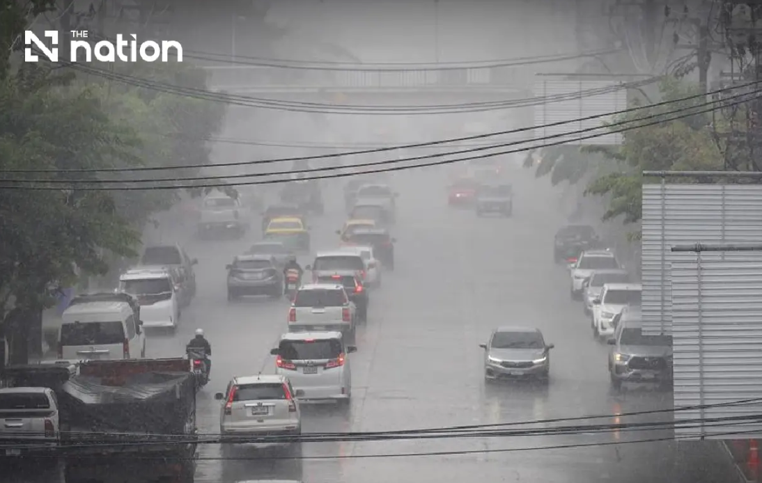
Thailand faces a critical three-day weather event as the Meteorological Department escalates its alert system to warn residents of mounting flood risks across the country's northern and northeastern corridors. The ninth official warning, issued Wednesday evening, underscores the severity of atmospheric conditions converging over upper Thailand, with meteorologists predicting that accumulated rainfall combined with existing soil saturation could trigger flash floods and rapid water run-off that could prove catastrophic for vulnerable communities.
The primary meteorological culprit is a monsoon trough that has positioned itself across Thailand's northern highlands while a robust southwest monsoon system simultaneously covers the Andaman Sea and Gulf of Thailand. This dual pressure system creates an environment where moisture-laden air continues to feed into the region, sustaining heavy precipitation over a three-day window extending through Friday. The combination mirrors classic tropical monsoon dynamics that have historically produced some of Thailand's most damaging seasonal floods, particularly in areas where geographical features concentrate and accelerate water flow.
For northern Thailand, the situation appears especially precarious. Seven provinces are bracing for very heavy rainfall conditions, including Mae Hong Son, Lampang, Nan, Phrae, Uttaradit, Phitsanulok and Phetchabun, while an additional eight provinces face heavy precipitation. With thunderstorm coverage expected to blanket eighty percent of the North between Wednesday evening and Thursday evening, the region essentially faces continuous or near-continuous moisture delivery. Communities situated in foothill regions and near natural water courses face the highest jeopardy, as topography will funnel runoff into valleys and stream channels with potentially rapid accumulation.
The Northeast region encounters similarly formidable conditions, with meteorologists projecting thunderstorm development across eighty percent of the area. Eight provinces are designated for heavy rain while another eight face very heavy downpours. The provinces of Loei, Nong Khai, Bueng Kan, Udon Thani, Sakon Nakhon, Nakhon Phanom, Kalasin and Mukdahan are flagged as especially vulnerable to extreme precipitation. The Northeast's topography, characterised by numerous tributaries feeding into the Mekong River system, means that sudden heavy rainfall translates quickly into swollen waterways and inundated agricultural plains.
The Central region and eastern provinces also fall within the warning envelope, though with somewhat lower risk classifications. Central Thailand is forecast to experience thunderstorms across sixty percent of its area with heavy rain possible in six provinces including Nakhon Sawan and Ratchaburi. The eastern region faces seventy percent thunderstorm coverage with particular concern for Trat province, which could experience very heavy precipitation. These wider geographical impacts suggest the weather system is substantial and far-reaching rather than concentrated in isolated pockets.
Authorities have issued specific guidance for high-risk populations, emphasising that residents in foothill communities adjacent to waterways and those in naturally low-lying terrain require heightened vigilance. The warning explicitly addresses the compounding effect of earlier rainfall, noting that soil moisture conditions across Thailand have already been elevated by the broader monsoon season. When additional heavy precipitation falls upon already-saturated ground, the capacity for water infiltration diminishes sharply, forcing runoff into surface channels. Motorists have been cautioned to avoid routes with documented flooding histories, particularly low-elevation roads where water can accumulate with startling rapidity during intense storms.
Maritime conditions add another dimension to the alert. The same atmospheric systems elevating flood risk inland are simultaneously generating hazardous wave conditions across both the Andaman Sea and Gulf of Thailand. The upper reaches of these water bodies are experiencing wave heights of two to three metres, with conditions exceeding three metres when thunderstorms develop overhead. Small vessels operating in the upper Andaman Sea and upper Gulf have been advised to remain anchored ashore through August 21, as the combination of heavy rainfall reducing visibility and elevated sea state creates compounding navigation hazards. Larger commercial vessels are instructed to exercise exceptional caution and avoid thunderstorm cells.
Southern Thailand's eastern coast faces comparatively moderate impacts, with thunderstorms expected across forty percent of the region primarily affecting four provinces from Phetchaburi through Surat Thani. However, the coastal orientation of these provinces means that wind patterns remain important for maritime safety. Southwesterly winds reaching twenty to thirty-five kilometres per hour will combine with wave heights of two to three metres, creating rough conditions for smaller fishing and transport vessels operating in these waters.
The environmental context for this event reflects broader climate patterns affecting Southeast Asia during the boreal summer monsoon season. Thailand's monsoonal climate means that July through September regularly deliver heavy precipitation, yet meteorologists' decision to issue nine separate warnings indicates that current rainfall totals and intensity projections substantially exceed typical seasonal norms. The concentration of warnings on the northern and northeastern regions points to particular moisture convergence in these areas, likely related to the specific positioning of the monsoon trough.
For Malaysia and other Southeast Asian nations, Thailand's weather situation carries indirect significance. The broader monsoon system affecting Thailand operates across the entire subregion, and the intensity of Thailand's atmospheric conditions provides early indication of potential moisture transport patterns that could affect neighbouring countries. Additionally, transboundary river systems linking Thailand with neighbouring states mean that significant flooding in Thai river basins can eventually translate into downstream impacts for communities in adjacent nations.
Temperature conditions across all affected regions remain typical for Thailand's monsoonal period, with minimums ranging from twenty-two to twenty-seven degrees Celsius and maximums from twenty-eight to thirty-six degrees Celsius depending on location. These warm conditions support continued moisture evaporation and atmospheric instability, meaning that the meteorological environment remains primed for ongoing thunderstorm development and heavy precipitation throughout the forecast period. The convergence of monsoon systems, pre-existing soil moisture, vulnerable topography and continuing warm atmospheric conditions creates a scenario where significant flood impacts must be anticipated across affected areas.

