South Korea is moving forward with its ambitious space surveillance programme, preparing to launch its fourth domestically-developed Earth observation satellite. The Korea AeroSpace Administration has scheduled the mission for early Tuesday morning at 4.10 pm Korea time, utilising SpaceX's Falcon 9 rocket departing from Vandenberg Space Force Base in California. This launch represents another milestone in Seoul's push toward greater self-sufficiency in space-based monitoring and intelligence gathering.
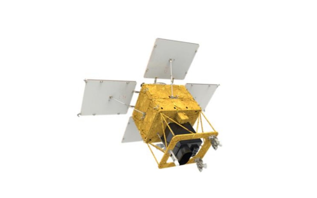
The satellite, weighing 500 kilogrammes, has undergone thorough preparation over the preceding month, with all functional inspections and fuel loading now complete. Engineering teams have verified the systems and confirmed the spacecraft's readiness for its journey into orbit. The timing of the launch reflects careful coordination between South Korean space authorities and SpaceX, ensuring optimal conditions for the mission's success.
Once released from the launch vehicle approximately two hours and 22 minutes after liftoff, the satellite will begin its critical descent into designated orbital parameters. Within roughly half an hour of separation, ground controllers expect to receive the initial confirmation signal through the Svalbard tracking station positioned in Norway, a crucial verification that the spacecraft survived the violent ascent and achieved stable flight. This contact marks the psychological turning point for any satellite mission, transitioning from launch risk to orbital operations.
The satellite's payload incorporates several homegrown technological systems developed by South Korean engineers and manufacturers. Most significantly, it features an advanced observation camera with sufficient resolution and coverage to image the entire Korean Peninsula at regular three-day intervals. This capability enables comprehensive tracking of environmental conditions, infrastructure changes, and other surface phenomena across both North and South Korea without reliance on foreign surveillance platforms.
South Korea's government has outlined an expansive vision for this satellite's practical applications. Agricultural planners can utilise the imaging data to monitor crop conditions and optimise farming practices across the nation. Forestry officials gain the ability to track woodland health, identify disease outbreaks, and detect unauthorised logging activities in real time. The system also promises enhanced disaster response capabilities, allowing authorities to rapidly assess damage from earthquakes, floods, or other emergencies and coordinate rescue efforts more efficiently.
The satellite will contribute meaningfully to South Korea's climate change research infrastructure. Scientists can analyse long-term patterns of coastal erosion, glacial retreat, vegetation shifts, and other environmental transformations using consistent, high-quality imagery. Urban planners and public safety officials will access data supporting infrastructure development decisions, emergency preparedness planning, and security monitoring. The versatility of such Earth observation systems makes them increasingly essential components of modern governance and scientific research.
Reaching its intended orbital altitude of approximately 888 kilometres above Earth's surface, the satellite will enter a commissioning phase lasting four months. During this period, technicians will conduct exhaustive testing of all systems, calibrate instruments, validate data quality, and fine-tune operational procedures. This deliberate approach, while extending the timeline to full operational capability, significantly reduces the risk of technical failures that could compromise the mission's long-term success.
Full-scale operational missions are expected to commence in the first half of next year, following successful completion of the initial orbital checkout. This phased implementation approach reflects established best practices in the international space community, allowing time to address any unforeseen technical issues before the satellite becomes fully integrated into government agencies' monitoring networks and service delivery systems.
For Southeast Asian observers, South Korea's advancement in indigenous Earth observation capabilities carries strategic implications. The region faces recurring challenges including agricultural vulnerability to climate variability, vulnerability to typhoons and flooding, deforestation pressure, and transboundary environmental concerns. As South Korea demonstrates growing technical capacity and cost-effectiveness in space-based monitoring, neighbouring nations may increasingly consider collaborative arrangements or commercially available data services to enhance their own environmental management and disaster response capabilities, potentially reshaping the regional geopolitical technology landscape.