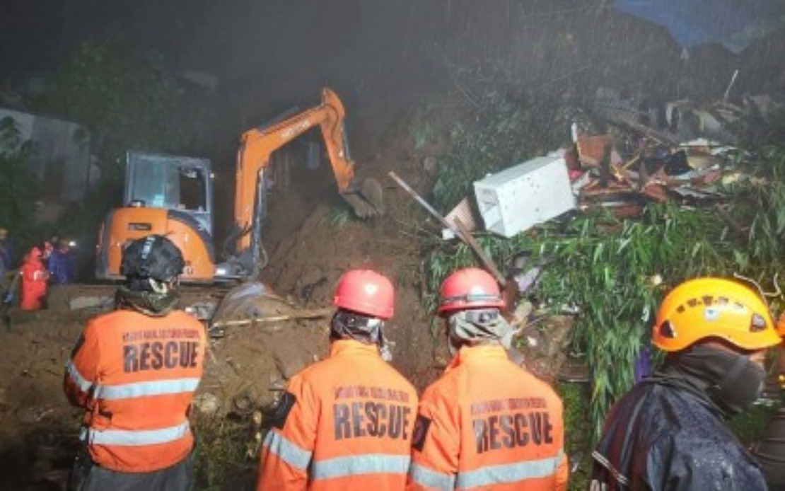
The Philippines is confronting a severe humanitarian situation as consecutive tropical weather systems have claimed 19 lives and displaced nearly 2.3 million residents across the nation. The Office of Civil Defence (OCD) confirmed the casualty figures on Tuesday following the passage of Tropical Depressions Luis and Maymay, which overlapped with the Southwest Monsoon period, creating compounding weather hazards across multiple island regions. The simultaneous occurrence of these meteorological phenomena has stretched disaster response infrastructure and raised urgent questions about climate resilience in Southeast Asia's typhoon-prone zones.
The regional distribution of fatalities reveals the uneven geographic impact of the weather system. Benguet province bore the heaviest toll with twelve confirmed deaths, reflecting the particular vulnerability of highland communities to sudden floods and landslides triggered by sustained rainfall. Four additional deaths were recorded in Rizal, an important logistics hub east of Manila, while Batangas in the southern Calabarzon region accounted for three fatalities. OCD public information officer Diego Mariano noted that verification of additional deaths was still underway, suggesting the preliminary toll may rise. The concentration of fatalities in specific provinces highlights how topography, settlement patterns, and infrastructure quality create variable risk profiles across the archipelago.
Beyond immediate loss of life, the weather disturbances have left fifteen people injured and created uncertainty for four missing persons. Benguet again features prominently with twelve of the fifteen recorded injuries, underlining the severity of ground conditions in that mountainous province. Individual casualties in Ilocos Sur, Rizal, and Cavite suggest the weather system's reach extended across significant portions of Luzon's landmass. The three missing persons concentrated in Benguet and one in Batangas compound the humanitarian concern, with search operations potentially hindered by continuing unstable terrain and waterlogged access routes.
The scale of displacement reveals the systemic nature of the crisis. The OCD documented approximately 646,676 families—totalling 2.27 million individuals—facing disruption across ten distinct geographic zones spanning both Luzon and the Visayas. This enumeration encompasses the Ilocos Region along the northwestern coast, the agricultural heartland of Central Luzon, the economically significant Calabarzon corridor, the disaster-prone Bicol Region, Cagayan Valley in the northeast, the Cordillera highland region, Metro Manila itself, and areas extending into Western Visayas and the Mimaropa region. The geographical breadth indicates this was not a localized event but a systemic weather pattern affecting interconnected economic and social systems across multiple provinces.
Emergency shelter capacity has been rapidly activated to address displacement needs. The OCD reported that 919 evacuation centres have been established to accommodate approximately 26,174 families comprising 94,997 individuals in need of immediate housing. This figure represents roughly 4 percent of those affected, suggesting the majority of displaced persons have sheltered with extended family, in community spaces, or have remained in damaged homes. The magnitude of evacuation centre activation indicates stress on local government resources, as municipal authorities must manage logistics, sanitation, medical services, and food provision across numerous dispersed facilities.
Structural damage assessments documented 639 partially damaged houses and 45 totally destroyed residential structures. While these figures, scaled against millions affected, suggest lower demolition rates than some tropical cyclone events, the actual impact on individual families experiencing total home loss is profound. Partial damage often necessitates costly repairs beyond the means of low-income households, effectively displacing families even where structures remain technically habitable. The repair and reconstruction burden will likely persist for months, testing government support mechanisms and charitable responses.
Infrastructure damage, estimated at PHP1.46 million (approximately RM97,000), reflects disruption to roads, bridges, water systems, and communications networks essential for disaster response and economic activity. In a nation where inter-island connectivity depends heavily on maritime and aviation links, damage to transport infrastructure amplifies the crisis by complicating relief delivery and isolating affected communities. Agricultural damage estimates of PHP135.33 million represent a more substantial economic shock, threatening food security in regions dependent on seasonal harvests. Tropical depressions hitting during harvest periods or planting seasons can devastate annual yields, affecting both farmer livelihoods and domestic food supply chains.
The simultaneous impact of two named tropical depressions overlapping with the Southwest Monsoon represents a compound meteorological hazard less frequently discussed in regional disaster preparedness frameworks. While individual tropical systems and monsoon rains are anticipated seasonal events, their temporal coincidence amplifies rainfall accumulation and extends the duration of hazardous conditions. Terrain saturation reaches critical thresholds more rapidly when systems overlap, triggering cascading failures in hillside stability and drainage systems. This pattern suggests that Philippine disaster planning increasingly requires scenario modeling for multiple concurrent weather systems rather than single-event assumptions.
The Philippines' disaster management apparatus has demonstrated capacity to rapidly mobilize response infrastructure, yet the scale of affected population raises sustainability questions. The OCD's swift verification of casualties and quantification of affected populations reflects institutional preparedness, but the challenge of supporting 2.2 million people across dispersed geography stretches both government budgets and logistics networks. For Malaysian observers, the Philippine experience serves as a cautionary illustration of how regional weather patterns and geographic vulnerability create humanitarian crises that can persist for extended periods beyond initial headlines.
Longer-term recovery prospects depend on resource mobilization at national, provincial, and municipal levels. The agricultural damage, while substantial in monetary terms, may prove more consequential than structural damage if it triggers food price volatility or rural livelihood crises. Government assistance programs, international aid coordination, and private sector participation in reconstruction will collectively determine whether communities rebuild to previous standards or experience degraded conditions. The typhoon-prone nature of the Philippines ensures that disaster response remains perpetually urgent, competing with development spending for constrained public budgets.
Regional implications extend beyond immediate Philippine borders, as the weather system underscores the interconnected climate vulnerabilities characterizing Southeast Asia. Vietnam, Thailand, and Indonesia similarly face tropical depression and monsoon hazards with comparable population exposure. The Philippine case demonstrates how rapid verification systems and public communication—evident in the timely OCD briefings—serve as critical components of disaster management infrastructure. As Southeast Asian nations collectively experience more intense and erratic weather patterns, the Philippine response model offers lessons about both capabilities and capacity limits in managing large-scale displacement and infrastructure damage across archipelagic geographies.

