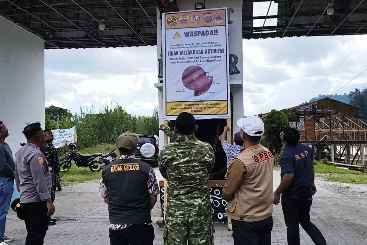
Tourism infrastructure around Mount Sinabung in North Sumatra's Karo regency has been shuttered indefinitely as Indonesia's volcanic monitoring authorities respond to escalating seismic and eruptive signals from the 2,460-metre peak. The Karo regency administration implemented the closure beginning August 19, affecting Lau Kawar Lake and an associated camping area in Kuta Gugung village, Naman Teran district. The decision followed a formal recommendation from the Vulcanology and Geological Disaster Mitigation Center's Mount Sinabung monitoring command post, according to Juni Antomi Kemit, head of the Karo Youth Affairs, Sports and Tourism Agency.
The precautionary measures reflect a substantial shift in the volcano's behaviour. Mount Sinabung's alert level has been elevated from Level I Normal to Level II Waspada (advisory), the second tier in Indonesia's four-level volcanic alert system. Armen Putra, who heads the Mount Sinabung monitoring post, confirmed that authorities have established protective zones around the volcano—recommending residents and visitors maintain a distance of at least three kilometres from the summit and 4.5 kilometres in the south-eastern sector. For those dwelling along waterways fed by streams originating on the mountain's slopes, officials have emphasized the need for heightened awareness regarding potential lahars, or volcanic mudflows.
The escalation comes after several days of intensified volcanic tremors and visible atmospheric discharge. Monitoring data collected through August 27 revealed five volcanic earthquakes recorded within Mount Sinabung itself on a single morning, complemented by several tectonic earthquakes detected in the surrounding region. By comparison, the preceding day had registered just one volcanic quake alongside seven tectonic tremors. The pattern of increasing seismic frequency carries particular significance in volcanic science—each additional earthquake potentially signals rising magmatic pressure and an elevated probability of eruption. Armen noted that thick smoke plumes have been observed rising between 100 and 800 metres above the summit, visible evidence of continued degassing and thermal activity.
This current alert follows a notable history of eruptions that has shaped the volcano's relationship with surrounding communities. After remaining dormant for approximately four centuries, Mount Sinabung awakened dramatically on August 29, 2010, marking the beginning of a new eruptive cycle. The 2010 event proved relatively brief, with activity subsiding by September that year. However, subsequent eruptions in September 2013 and particularly a major outburst in November 2013 demonstrated the volcano's capacity for destructive force. The November 2013 eruption, which escalated the alert to Level IV Awas (warning), the highest designation in Indonesia's system, generated deadly pyroclastic flows that claimed dozens of lives and forced approximately 21 villages and two hamlets to evacuate their residents.
Following that catastrophic event, Mount Sinabung entered an extended phase of continuous eruptive activity spanning six years. The volcano maintained elevated alert levels throughout this period, necessitating ongoing evacuation protocols and restrictions on human activity across broad zones surrounding the volcano. This protracted unrest gradually subsided, prompting authorities to lower the alert status to Level III Siaga (watch) on May 20, 2019, after instrumental monitoring and visual observations suggested the volcanic threat was diminishing. However, the relative calm proved temporary. On July 28, 2021, Mount Sinabung erupted again with considerable force, ejecting volcanic ash columns to heights of 4,500 metres and launching pyroclastic flows eastward and south-eastward to distances of 1,000 metres. That eruption, the most recent before the current surge, affected at least five districts and blanketed vast areas under layers of fine volcanic ash.
The August 2024 alert elevation signals that Mount Sinabung remains far from dormancy and continues to pose risks to regional infrastructure and populations. For Malaysian and regional observers, the situation underscores the dynamic nature of volcanic hazards across the Indonesian archipelago, which sits atop one of the world's most seismically and volcanically active zones. The closure of tourism facilities, while economically disruptive to local communities dependent on visitor spending, reflects the precautionary approach mandated by international volcanic safety standards. Authorities have prioritized public safety over commercial interests—a stance justified by the volcano's demonstrated capacity for sudden, violent eruptions capable of affecting areas well beyond the immediate vicinity of the summit.
The monitoring command post continues to maintain continuous surveillance of Mount Sinabung using seismometers, visual observation stations, and other instrumental networks deployed across the volcanic field. Real-time data feeds inform decision-making regarding alert level adjustments and evacuation orders. For the population living in the volcano's shadow, this ongoing vigilance represents both a protective measure and a reminder of the geological forces that continue to shape the landscape and human occupation of North Sumatra's volcanic highlands. The current advisory status, while falling short of the highest warning level, nonetheless reflects genuine concern among volcanologists regarding the trajectory of activity and the volcano's unpredictable nature.

