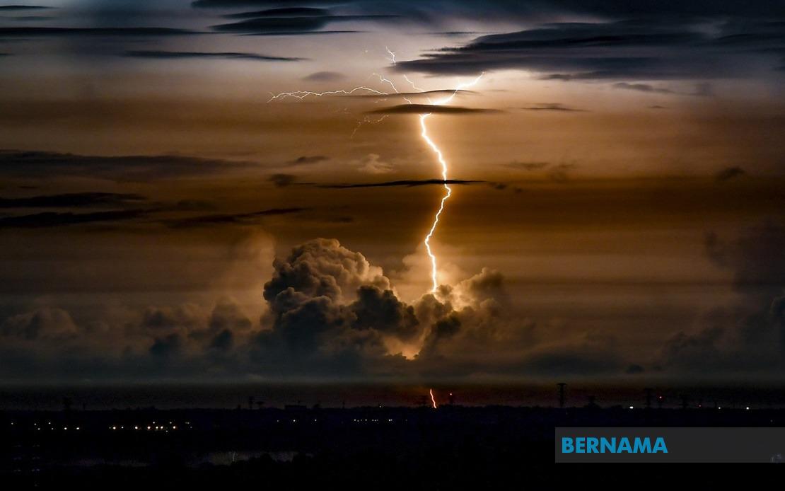
The Malaysian Meteorological Department (MetMalaysia) has activated a nationwide weather alert, warning residents across nine states to prepare for hazardous conditions including thunderstorms, intense rainfall and powerful winds that will remain in effect until the early hours of the morning. The advisory, issued on July 18, signals heightened meteorological risk across multiple regions spanning the peninsula's west coast, east coast and Malaysian Borneo, affecting both densely populated urban zones and more remote administrative divisions.
Southern Peninsular Malaysia faces particularly widespread exposure to the incoming system. The entire state of Melaka has been placed under alert status, while significant portions of Johor are in the warning zone, specifically the districts of Tangkak, Muar, Batu Pahat, Pontian and Johor Bahru. This configuration means residents in Malaysia's second-largest city and the southern industrial belt should exercise heightened caution during the warning period. The inclusion of Melaka in its entirety suggests the meteorological threat extends across a substantial geographic footprint with potential for widespread impact on road conditions and public infrastructure.
Kedah and Perak in the northern region face localised but significant risk. Only the Baling district in Kedah has been flagged, suggesting the system's northern penetration is concentrated in specific areas. Perak's exposure is confined to Hulu Perak, the state's inland district, indicating that the weather pattern has a distinct geographic signature rather than blanket coverage. This targeted approach by MetMalaysia allows residents in adjacent areas to maintain more normal routines while those in flagged zones prepare defensive measures.
The East Coast of Peninsular Malaysia bears the brunt of the meteorological system, with both Kelantan and Terengganu heavily affected. In Kelantan, twelve separate districts have been placed under alert—Tumpat, Pasir Mas, Kota Bharu, Jeli, Tanah Merah, Bachok, Machang, Pasir Puteh and Kuala Krai—representing substantial coverage across the state. Terengganu similarly faces multi-district exposure across Besut, Setiu, Kuala Nerus, Hulu Terengganu, Kuala Terengganu and Marang. The concentration of warnings on the east coast reflects the monsoon circulation patterns and geographical vulnerability of these regions during certain seasons, creating recurring challenges for coastal and interior communities alike.
Pahang's highland and central regions are also in the warning corridor. Cameron Highlands, the nation's premier hill station and agricultural hub, sits alongside Lipis, Raub and Bentong in the alert zone. The inclusion of these areas is particularly significant given Cameron Highlands' elevation and its role as a critical agricultural producer. Heavy rainfall on highland terrain can trigger flash flooding in valley settlements and disrupt supply chains for vegetables and produce destined for national markets. Residents and businesses in these districts must prepare for potential disruptions to transportation and utilities.
Sabah's eastern districts face the system's eastern extension. Telupid, Kinabatangan and Sandakan have been designated as warning areas, reflecting how the meteorological threat crosses into Malaysian Borneo. Sandakan, a significant port city, warrants particular attention given potential maritime complications. Sarawak similarly experiences the system's reach, with warnings covering Beluru, Telang Usan, Miri, Marudi and Limbang—a geographically dispersed set of districts spanning the state's interior and coastal zones. The simultaneous activation of warnings across both Malaysian Borneo states demonstrates the continental scale of the weather system.
The hazard profile specified by MetMalaysia encompasses three distinct meteorological dangers. Thunderstorms bring lightning risk and sudden convective intensity. Heavy rainfall creates flash flood potential, particularly in areas with inadequate drainage or topographical vulnerability. Strong winds pose threats to poorly anchored structures, vegetation and exposed activities. The combination of all three elements creates a compounding risk scenario where communities must prepare for multiple simultaneous hazards rather than isolated weather phenomena.
The temporal specificity—a warning extending until 1 am—provides a defined window for preparation and response. This suggests MetMalaysia's forecasters have modelled the system's progression and anticipate the primary threat period to conclude during the early morning hours. Residents, emergency services and utility providers can calibrate their responses around this timeline, maintaining heightened alertness during the warning period while preparing for normalisation thereafter. The overnight timing compounds challenges, as darkness reduces visibility for emergency responders and limits community awareness of unfolding hazards.
For Malaysian readers accustomed to tropical weather patterns, such alerts reflect the nation's exposure to monsoon systems and afternoon convection. The geographic spread of this particular warning—spanning nine states from Melaka to Sabah—indicates a substantial atmospheric system affecting diverse regions simultaneously. Community resilience requires that residents heed such advisories seriously, ensure household preparations are complete before conditions deteriorate, secure outdoor items, verify drainage sufficiency and maintain communication channels during the warning window. For those in flood-prone areas, maintaining awareness of evacuation routes and emergency contact numbers proves prudent.
Emergency management authorities across the nine affected states should have activated standard protocols, positioning resources and personnel to respond to weather-related incidents. The Malaysian authorities' meteorological capabilities have matured substantially, enabling increasingly detailed spatial and temporal forecasting that helps communities and institutions prepare proportionately. Compliance with such warnings remains essential, as the combination of thunderstorms, heavy rain and strong winds can rapidly escalate from inconvenient to dangerous, particularly where topography, drainage or infrastructure vulnerability amplifies the risks inherent in intense tropical weather.

