The root cause of a catastrophic mudslide that struck Gyirong Port in southwestern Xizang on August 26 has been definitively traced to a glacier collapse originating in neighbouring Nepal, according to findings released by Chinese regional authorities on Sunday. Investigators determined that fracturing along a glacier situated on the southern flank of Mount Langtang Lirung initiated a massive ice-rock avalanche at approximately 5,200 metres elevation, setting in motion a chain of geological events that would prove fatal for residents and workers across the border in China.
The initial avalanche descended with extraordinary speed and force, accumulating additional debris as it plunged downslope to around 4,000 metres. As the ice and rock mass gained momentum and volume, it transformed into a destructive debris flow that carved a path of devastation across the mountainside. The resulting mudslide continued its relentless advance, traveling approximately 22 kilometres before arriving at Gyirong Port, located at roughly 1,800 metres elevation, where it unleashed its full destructive capacity on the unsuspecting settlement below.
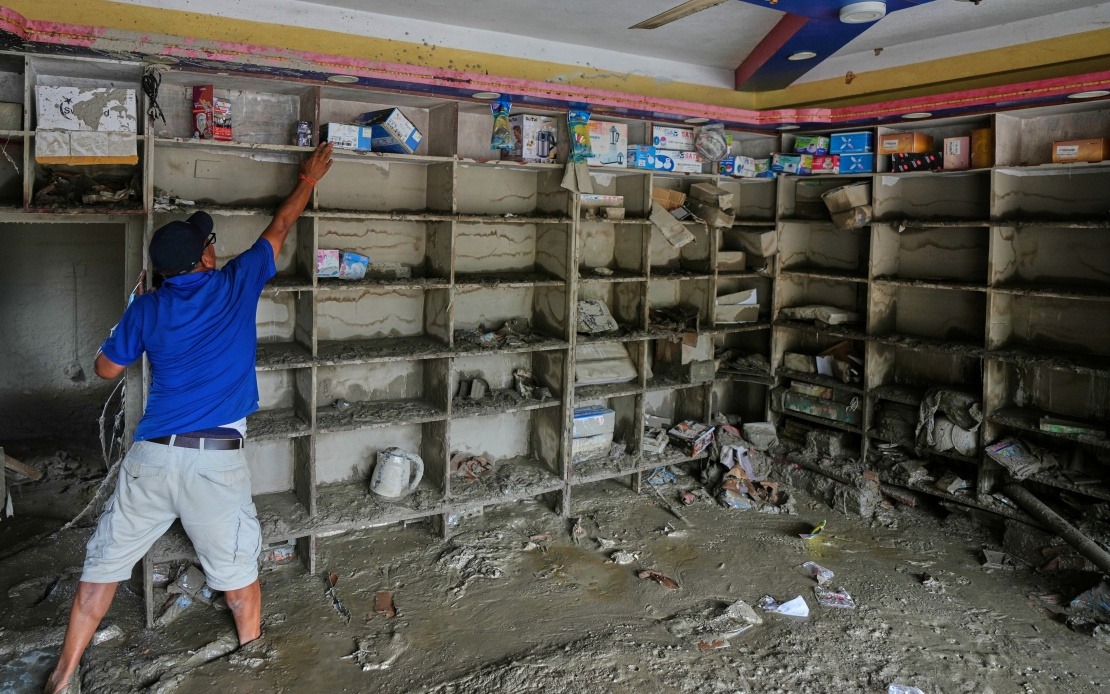
The scale of the destruction has proven immense. The mudslide flattened an area covering approximately 0.7 square kilometres, obliterating 27 structures including buildings and associated facilities. As of Saturday evening, the official death toll stood at 16 persons, with a further 546 individuals reported missing, according to declarations from the regional government issued Sunday morning. These figures underscore the sudden and overwhelming nature of the disaster, which offered minimal warning to those in its path.
The identification of the avalanche's origin represents a significant finding in understanding cross-border geological hazards in the Himalayan region. A specialized cryosphere emergency disaster response team deployed from the Institute of Mountain Hazards and Environment, operating under the auspices of the Chinese Academy of Sciences, conducted the investigation. Their methodology combined sophisticated remote-sensing monitoring technology with field-transmitted data collection and comprehensive on-site examinations, enabling them to trace the debris flow back to its source and establish the causal chain with scientific precision.
For Malaysia and other Southeast Asian nations, this incident carries important implications regarding mountain hazard management and transboundary disaster response. The Himalayan range, though geographically distant, influences weather patterns and climate systems affecting the broader Asian region. More immediately, the event demonstrates how natural disasters in high-altitude zones can generate consequences extending well beyond national boundaries, a concern that resonates for countries sharing mountainous terrain with neighbours.
The scientific investigation highlights the increasing vulnerability of high-altitude glacial zones to structural failure. Climate-related glacial retreat and weakening have become recognized hazards in the Himalayan system, where millions depend on glacier-fed water sources. The Langtang region, already affected by previous disaster events, exemplifies how environmental stress on frozen mountain assets can translate into catastrophic downstream consequences. Scientists monitoring the region have documented accelerating glacial change across the Himalayan massif, suggesting similar events may recur with greater frequency.
The transnational nature of this disaster underscores the necessity for enhanced cooperation between China and Nepal on shared mountain hazards. While the avalanche originated on Nepal's side of the border, the devastation occurred entirely within Chinese territory. Such incidents require coordinated monitoring systems, early warning protocols, and information-sharing arrangements that transcend political boundaries. The 1,800-metre elevation difference between the avalanche's origination point and impact zone compressed the response timeline to mere minutes or hours, leaving minimal opportunity for evacuation or protective measures.
Gyirong Port, situated along a critical trade route between China and Nepal, holds strategic and economic significance beyond the immediate human tragedy. The port facilitates bilateral commerce and serves as a transportation hub for goods and personnel crossing the Himalayan barrier. The destruction of 27 facilities within this commercial zone carries economic ripple effects extending beyond the disaster zone itself, affecting supply chains and trade connectivity across the broader region.
The role of remote-sensing technology in hazard assessment, as demonstrated by the Chinese Academy of Sciences investigation, points to evolving capabilities in monitoring high-altitude mountain zones. Satellite imagery and automated monitoring systems enable detection of glacial changes and early warning signs that might otherwise escape notice in remote, inaccessible terrain. As climate change accelerates, such technological capacities become increasingly valuable for risk management in mountain communities throughout Asia.
For residents and officials in mountain communities throughout the Himalayan arc—including Nepal, Bhutan, and indeed parts of northern India—the Gyirong disaster serves as a stark reminder of geological hazards that characterise high-altitude living. Communities perched in valleys below glaciated peaks face inherent risks that demand sustained vigilance and preparedness. The relatively sudden transformation of what may have appeared as a stable landscape into a channel of destruction underscores the need for comprehensive hazard mapping, monitoring systems, and evacuation planning.
The humanitarian response to this catastrophe will likely involve extensive search and rescue operations focused on locating the 546 missing persons. The challenging terrain, altitudinal compression, and ongoing geological instability following the main event complicate recovery efforts. International assistance, should it be requested, would need to navigate complex diplomatic channels while mountain weather conditions and geographic isolation present logistical obstacles to aid delivery and personnel movement.
Moving forward, the findings from this investigation will presumably inform glacial hazard management protocols throughout the region. The Chinese Academy of Sciences and Nepali scientific bodies may strengthen collaborative monitoring efforts focused on glacial stability in shared mountain zones. Such cooperation serves not merely academic or bureaucratic functions but holds direct life-and-death significance for populations inhabiting the densely settled valleys that characterise the lower Himalayan regions. The challenge of living safely in mountain environments where geological forces operate at scales exceeding human capacity for intervention remains a defining concern for millions across Asia.

