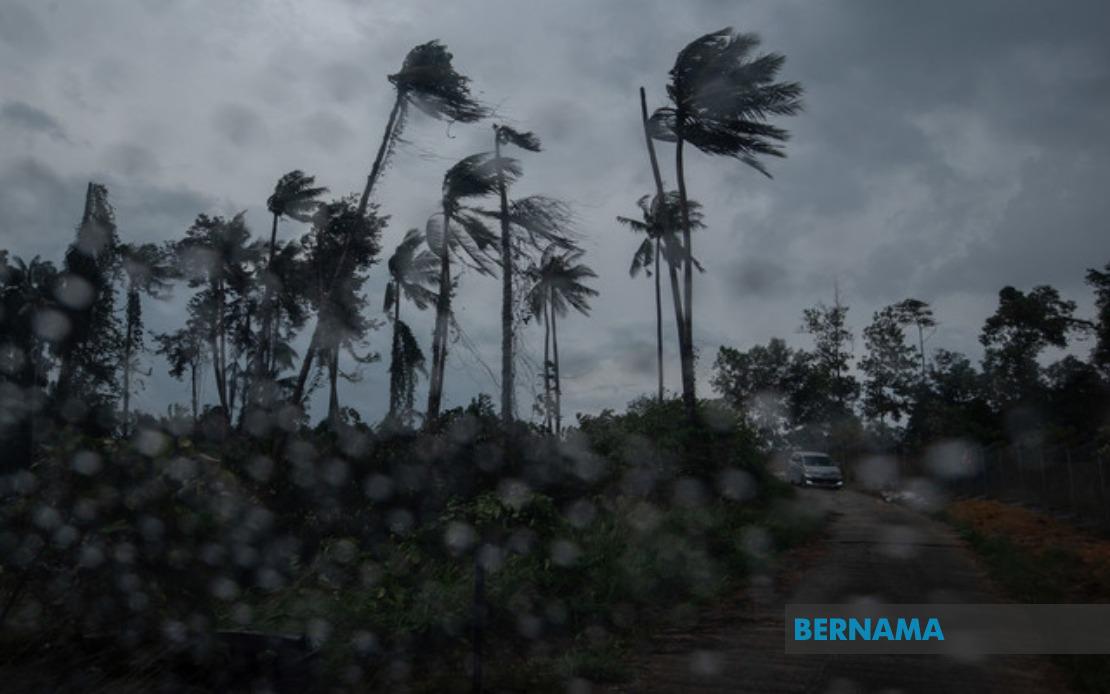
The Malaysian Meteorological Department (MetMalaysia) has placed nine states on alert for potentially severe weather, issuing an advisory at 2.40 pm warning of thunderstorms, heavy rainfall, and gusty winds expected to persist through the remainder of the afternoon. The warning underscores the unpredictability of the monsoon transition period, when Malaysia typically experiences heightened atmospheric instability and increased risk of localized severe weather events across multiple regions simultaneously.
In the northern region, residents across six districts of Kedah face the threat of hazardous weather conditions, spanning from the coastal flatlands of Baling and Sik through to the more developed urban zones of Kulim and Kuala Muda. The administrative districts of Pendang and Yan complete the alert area in the state. Neighbouring Penang has also been drawn into the warning zone, with both Seberang Perai Utara and Seberang Perai Tengah expected to experience the same severe conditions, potentially disrupting traffic and outdoor activities in this densely populated economic corridor.
The central Peninsular region faces equally widespread impacts, with Perak comprising the largest single-state alert area. Seven districts within the state—encompassing the highland areas around Mualim and Kinta, the industrial zones of Kampar, and the river valley settlements in Batang Padang, Perak Tengah, Hilir Perak, and Kuala Kangsar—fall under the warning parameters. This geographic spread suggests a weather system of considerable spatial extent capable of producing damaging winds and flash flooding across terrain ranging from elevated plateaux to low-lying riverine plains.
Terengganu's east coast positioning places four of its districts within the alert zone, namely Dungun, Marang, Kuala Terengganu, and Kuala Nerus. These areas, particularly the coastal municipalities, remain vulnerable to sudden atmospheric disturbances that can generate rapid sea surface responses and heightened tidal impacts. The inclusion of the state capital reflects confidence among meteorological analysts that the weather system will maintain sufficient intensity across the region through the afternoon period.
Pahang, Malaysia's largest state by area, has eight districts marked for potential severe weather, stretching from the highland Cameron Highlands through the densely forested interior districts of Lipis and Raub to the central plains around Temerloh and Maran. The inclusion of Bentong, Bera, and Rompin suggests the weather pattern's influence extends across the state's entire geographic breadth, from the western highlands to the eastern coastal hinterland. Such widespread territorial coverage indicates a substantial atmospheric disturbance capable of generating impacts across fundamentally different terrain types and climate zones within a single state.
In the southern region, Negeri Sembilan's five affected districts—Seremban, Jempol, Tampin, Kuala Pilah, and Jelebu—encompass the state's principal economic and administrative centres, potentially affecting transportation networks and business operations across the afternoon hours. Meanwhile, Johor's limited inclusion to only Segamat suggests the weather system's southern extent remains relatively contained, though residents in this western district should maintain heightened vigilance for developing conditions.
Across the South China Sea, Sarawak's warning coverage demonstrates the meteorological system's ability to influence weather patterns across considerable distances. Miri's interior district of Marudi, along with Limbang, Mukah, and the Sibu metropolitan area encompassing both Sibu proper and Selangau, face threatening conditions. The inclusion of Sarikei's districts of Maradong and Sarikei, alongside Bintulu's twin districts of Bintulu and Tatau, suggests a coherent weather disturbance affecting a long stretch of the state's territory. These areas depend significantly on maritime and aerial transportation links that may experience operational disruptions during the forecast period.
Sabah's affected regions centre on three geographic zones: the Interior Division spanning Keningau, Tambunan, Membakut, Tenom, Sipitang, and Beaufort encompasses highland and valley settlements where rapid runoff and flash flooding pose particular hazards. The West Coast division and Kudat district, incorporating Kota Marudu, represent the state's principal agricultural and development regions, where severe weather can significantly disrupt economic activities and supply chains. The geographic dispersion across the state's interior and coastal areas suggests a large-scale atmospheric feature rather than a localized storm cell.
Thunderstorm warnings during Malaysia's transitional monsoon periods carry particular significance for emergency management authorities. The concentrated afternoon timeline—with impacts expected until 5 pm—provides a relatively narrow window for the system's passage, though this timing coincides with peak afternoon heating that may intensify convective processes. Residents and business operators across all affected areas are advised to monitor conditions closely and exercise caution regarding outdoor activities, driving in areas with reduced visibility, and exposure to potentially damaging wind gusts that could affect structures and vegetation.
The simultaneous alert across nine states reflects the complexity of equatorial meteorological systems capable of generating severe convection across geographically vast areas in relatively short timeframes. Malaysian meteorological forecasting has advanced considerably through enhanced satellite monitoring and regional cooperation, enabling authorities to issue increasingly precise alerts that help residents and authorities prepare appropriate response measures. The afternoon deadline suggests weather model confidence in the system's movement and dissipation trajectory, though forecasters typically emphasize that convective systems can develop localized intensification and produce impacts exceeding initial expectations.

